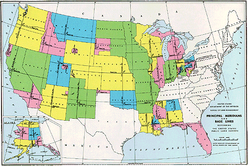
PLSS or "Public Land Survey System" is a map which depicts government ownership of certain lands. . PLSS maps divide land principal meridians and base lines, and divide it even further into subdivisions called townships. This map represents the Principal meridians and Base lines of the US as surveyed by the Bureau of Land Management.
No comments:
Post a Comment